Hiking
Kaimai Range Walks & Hikes
Please contact us if you would like to discuss options suitable for you.
Some of our favourites walks
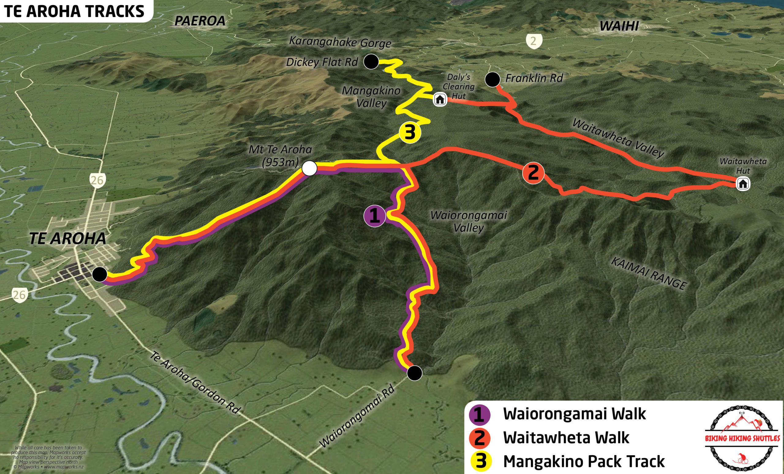
Waiorongomai or Mt Te Aroha to Waitawheta Valley
(Walk 2 on map)
23km -8/10 hours
Option to do over 2 days by staying at Waitawheta Hut/Campsite
Location
Start Te Aroha Domain or Waiorongomai car park.
Finish end of Franklin Road -Waihi end.
This can be walked in either direction but we recommend that you start at either Te Aroha or Waiorongomai so the hardest part of the walk is first.
Difficulty.
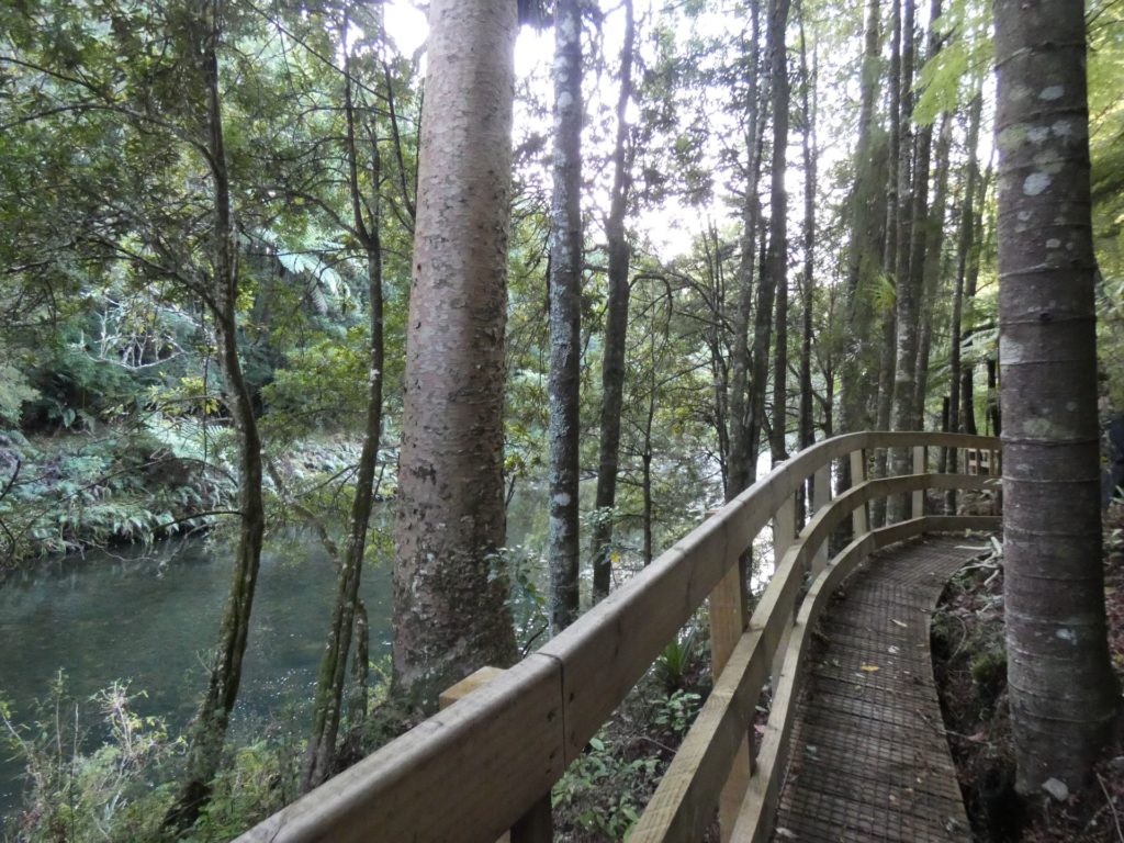
Suitable for experienced hikers or if you simply wish to walk in and out to Waitawheta hut from Franklin Road, then suitable for all abilities. Option to start at either Te Aroha Domain (via Mt Te Aroha) or Waiorongomai (avoiding Mt Te Aroha) a 14km hike from Te Aroha or Waiorongomai to Waitawheta Hut/Campsite, both routes involve significant uphill although Mt Te Aroha option is steeper and reaches a higher point, but both distances are similar. Most of the walk is through native bush with reasonably well marked tracks but a bit of attention is needed at some junctions. From Waitawheta Hut/Campsite it is a gentle 9km walk following the Waitawheta River out to the end of Franklin road - Waihi end.
Description.
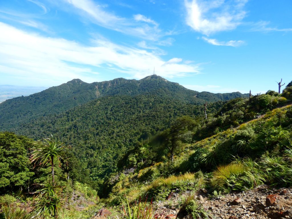
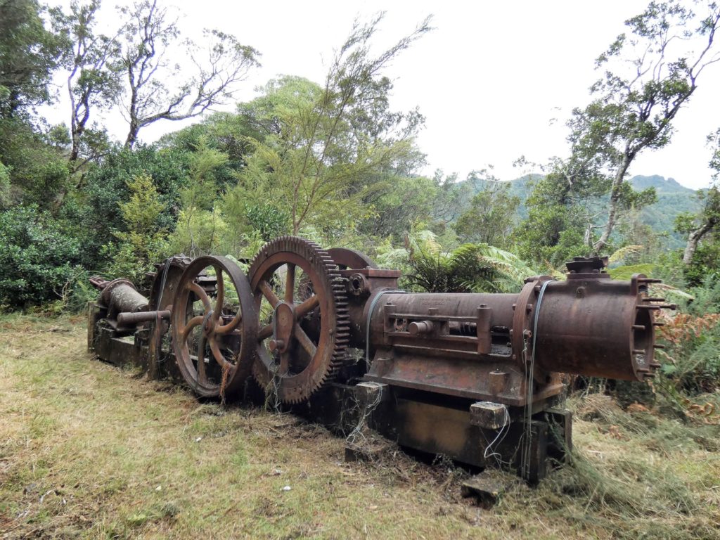
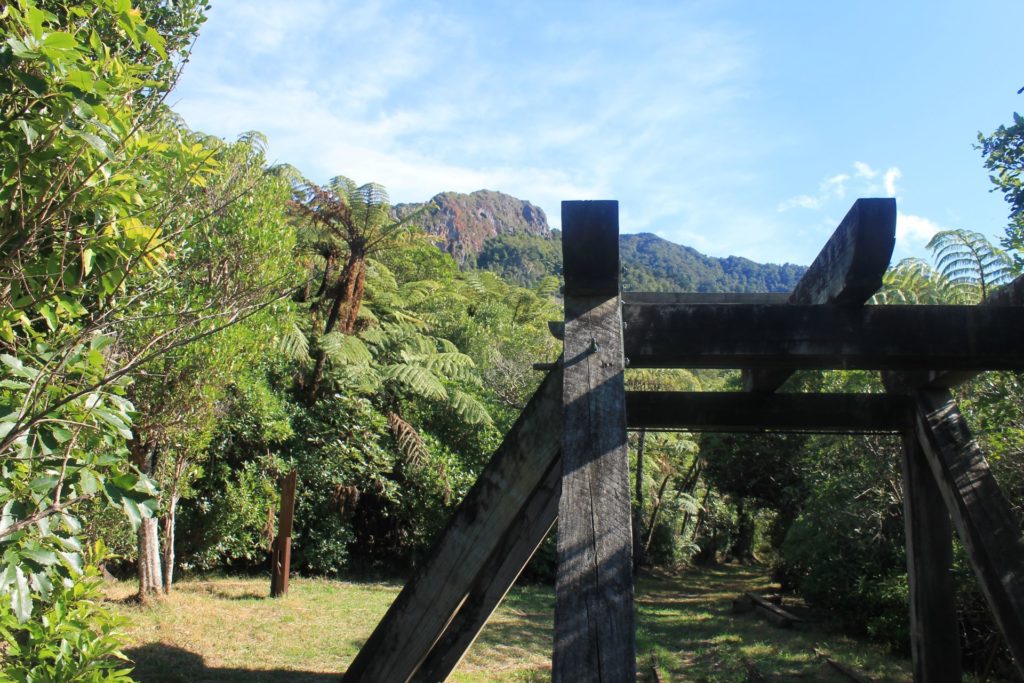
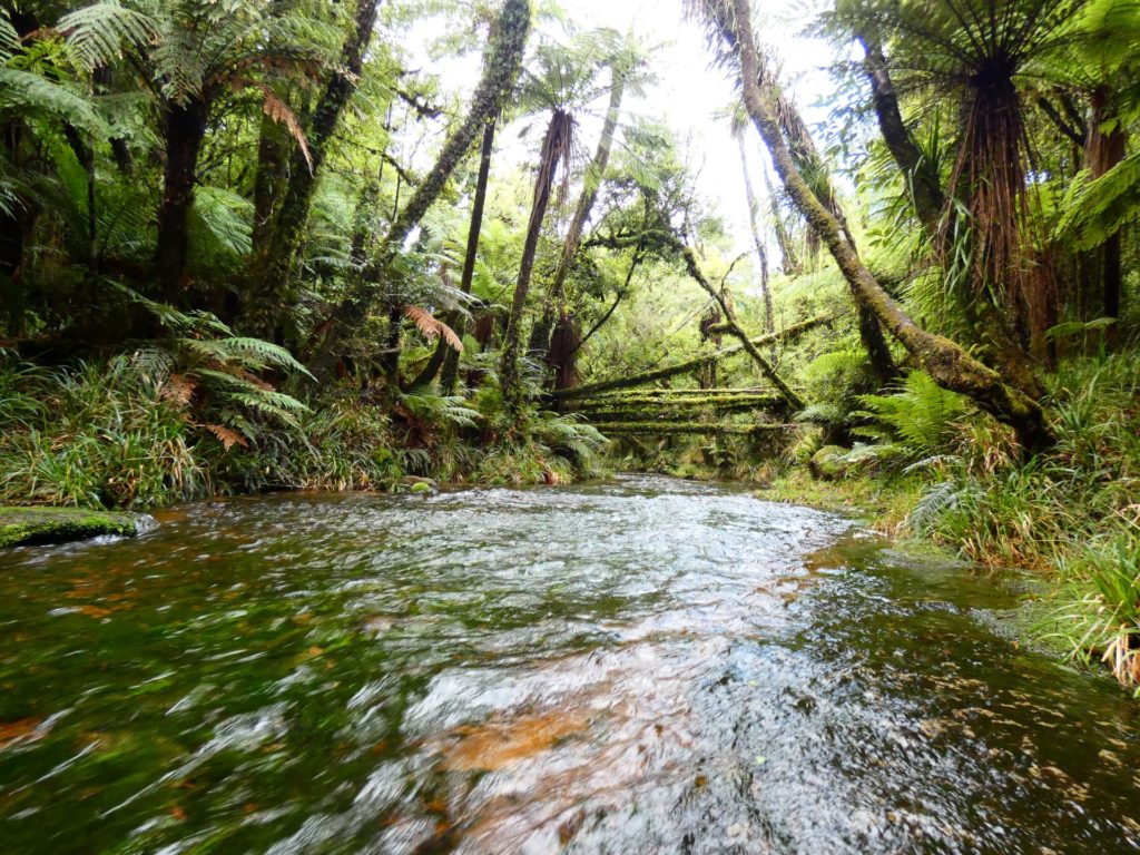
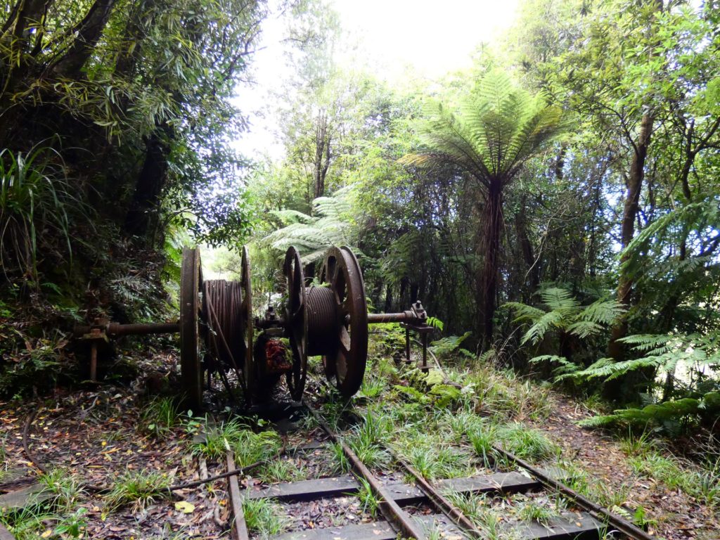
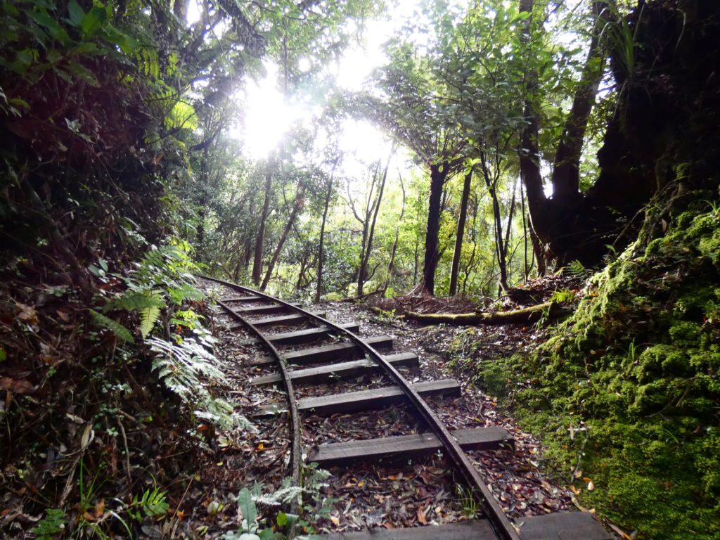
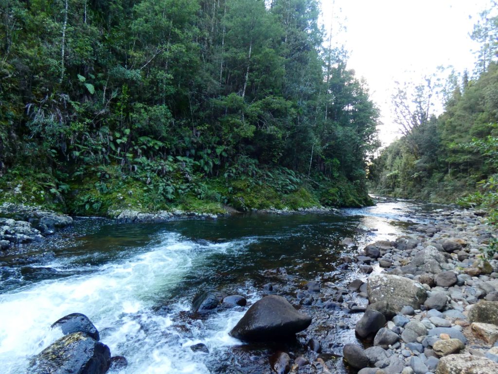
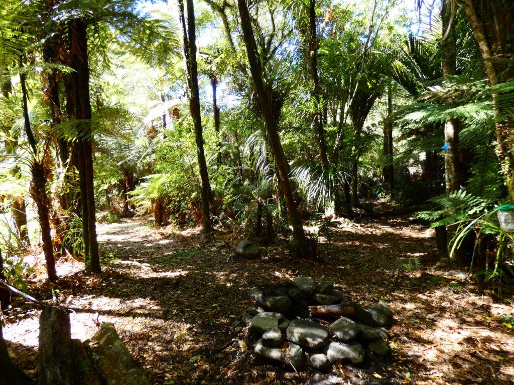
The section starting from Te Aroha takes in beautiful views out across Te Aroha Township & Hauraki Plains from Whakapipi lookout. Also the amazing 360 views from the top of Mt Te Aroha 953m, of Bay of Plenty and Hauraki plains (on a clear day it is possible to see Mt Ruapehu). The Waiorongomai Section, has all the history of gold mining plus historic Tramways. The section from Waitawheta Hut to Franklin Road is largely flat, very well marked and easy to follow the Waitawheta Tramway and river. This section has lots of history of the old Kauri timber mills and also plenty of options to enjoy a swim in the many water pools in the river.
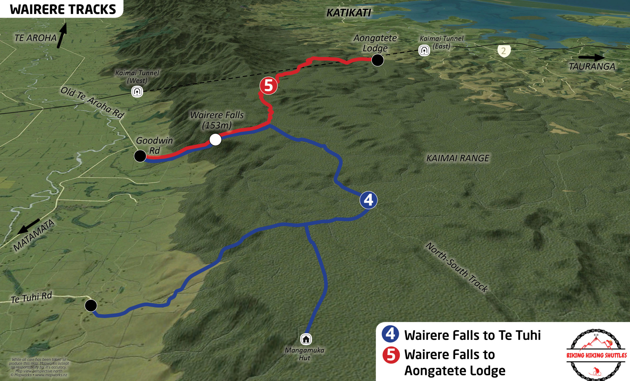
Wairere Falls to Aongatete Lodge
(Walk 5 on map)
15km -6/7 hrs
(Can be walked in either direction)
Location
Start Wairere Falls - Goodwin Road Car Park
Finish Aongatete Lodge - End of Wright Roads off SH2 Katikati, Aongatete
Description
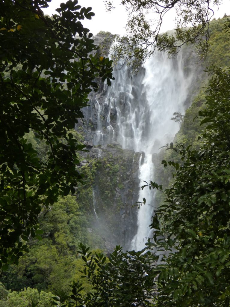
Suitable for keen hikers, steep climb up/down Wairere Falls (153m high) section with lots of steps, otherwise reasonable gradient, two significant river crossings towards the Aongatete Lodge end. Generally well route marked. A great walk for water lovers, stunning views of Wairere Falls and continuing to follow & cross both Wairere Falls stream and Aongatete River with beautiful swim holes towards both ends of the walk, especially Aongatete.
Te Aroha Domain to Waiorongomai
(Walk 1 on map)
12.5km -5hrs
Location
Start Te Aroha Domain by Te Aroha i-site Visitor Information Centre.
Finish Waiorongomai Road Car Park
Can be walked in either direction
Difficulty
Suitable for keen hikers, steep climb up or down, depending the direction you choose to walk the trail. Passing through mature bush, streams, over a swing bridge & through a tunnel (don’t forget your torch) linking Mt Te Aroha with the Waiorongomai tracks. A challenging hike but well worth it for the amazing 360 views from the top of Mt Te Aroha, then coming down through Waiorongomai, taking in Piako County Tramway and the historic gold mining areas. There are various alternative routes through Waiorongomai depending on your interests and energy levels
Description
Our suggestion would be to start with the climb up Mt Te Aroha and finish at the Waiorongomai end. This way you get the steep climb done first, however both directions are very beautiful and depends whether you prefer a shorter steep climb or a longer gentler climb. Depending which way you chose to walk the route the starting point is either Te Aroha Domain or Waiorongomai Road car park. There are various options for coming down/up through Waiorongomai.
Wairere Falls to Te Tuhi Track
(Walk 4 on map)
13.7 km -5 hrs
(Can be walked in either direction)
Location
Start Wairere Falls. Goodwin Road Car Park, between Matamata & Te Aroha.
Finish End of Te Tuhi Road, between Matamata & Te Aroha, off Old Te Aroha Road
Description
This can be walked in either direction but we recommend that you start at Goodwin Road Car Park & hike up the falls so the steepest part of the walk with lots of steps can be completed whilst feeling fresh. The Te Tuhi end, also has a steep descent down (or ascent up) depending the way you are hiking.
This is a beautiful walk to the top of Wairere Falls which provides views over the Waikato farmland. The trail follows the Kaimai plateau along a reasonable gradient through native bush with numerous small stream crossings. Shortly after joining the Te Tuhi track, which takes you down off the kaimais to the finish point, it is possible to detour to the Mangamuku Hut where you can stay the night.
Option
If you wish to make a real adventure of it and stay out overnight then you can detour to the Mangamuka Hut (basic 4 bunk hut) which is a 1.5hr detour off the Te Tuhi track towards the south end of the track.
Waiorongamai to Dickey Flat DOC Campground via Daly’s Clearing Hut
(Walk 3 on map)
25km -10 hrs
(Can be walked in either direction with the option of camping or staying overnight at Doc Huts or Campground)
Location
Start Waiorongomai Road car park or Te Aroha i-site, if walking via Mt Te Aroha
Finish Dickey’s Flat Campsite, Dickey Flat Road, Waikino.
Difficulty
Suitable for experienced hikers. Please note that the Mangakino Pack track to the Daly’s Hut signpost is quite rough in places with numerous washed out gullies and fallen trees forcing short off track detours.
Description
This trail takes you over the Kaimai Range through historic gold mining areas, native bush and magnificent mature Kauri Trees.
We recommend this trail is walked from Waiorongomai or Te Aroha to Dickeys Flat so the steepest part of the walk is tackled whilst still feeling fresh. Starting at Waiorongomai car park takes you up through historic gold mining areas, through a tunnel, across a suspension bridge before reaching the Mangakino Pack Track where you would join up with the Mt Te Aroha option.
The Mt Te Aroha option starts from Te Aroha i-site and takes you up and over the 953m climb of Mt Te Aroha.
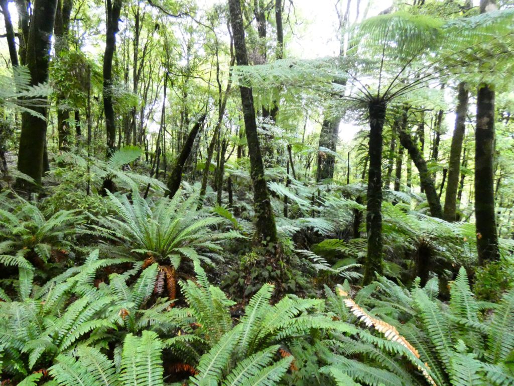
Mangakino Pack Track was a Horse track that linked the Waiorongomai Goldfields with Waihi in the north to the goldfields of the Waiorongomai Valley in the South. The Mangakino Pack section is a very rough track in places and not very well maintained. This track has an isolated but peaceful feeling as you walk through forest made up of predominantly Tawa trees and crossing small streams, linking Te Aroha to Dickey’s flat, near Karangahake Gorge. Along the track is Mangakino Shelter which has a Shelter & picnic bench, where you could also camp with fresh water nearby. The vegetation changes to a more tropical feel with Nikau Palms & Ponga Ferns alongside the track. Towards the end of the Mangakino Pack Track and also into Dickey’s Flat the trail passes through magnificent mighty Kauri trees and groups of Ricker (young Kauri stands).
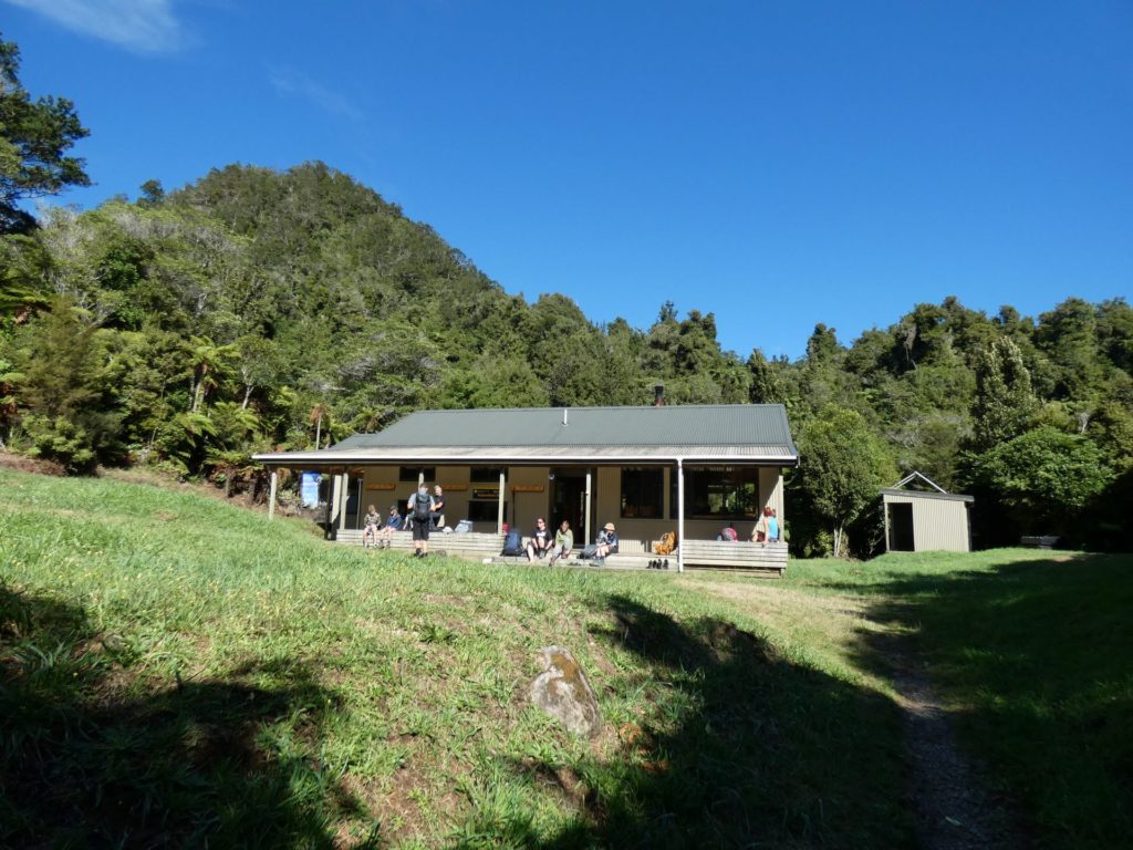
Option - Daly’s Clearing Hut is a 20minute walk off the main track. It’s a 16 bunk hut and is well set out, which would provide you with the opportunity to stay out overnight. Should you wish to extend the route even further you can walk through to the Waitawheta Valley.
The main Track continues towards Dickey’s Flat carpark, (from the signpost to Daly’s Clearing Hut) taking in two significant river crossings, one definitely will give you wet boots after rain, make sure you check the weather before you set off. It’s a gorgeous track from here, following the Waitawheta River with great swim holes, through bush & Kauri trees eventually bringing you out to the car park and camping area
Various routes/detours
Daly’s Clearing Hut 20min
Waitawheta Tramway 50min
Waitawheta Hut 2hrs 45min
Franklin Road via Daly’s Clearing Hut or Mangakino Pack Track 1hr 45min
Tuahu Track to Wairere Falls
(Walk 6 on map)
35km -16 hrs
(Can be walked in either direction, over 2 - 3 days with the opportunity to camp or stay overnight at a Doc Hut)
Location
Start or finish
Tuahu Track - Hot Springs Road (Katikati side). Wairakau Road (Te Aroha side).
Wairere Falls - Goodwin Road car park, between Matamata and Te Aroha
Difficulty
Suitable for keen hikers who are looking for a challenging and varied multi-day experience - the majority of the route (approximately 25km) follows the classic Kaimai North / South Trail. Generally well route marked with orange triangles but you will need to keep your eye out on some sections of the track which can be a little bit more overgrown.
A tent is recommended as there is only one hut on this route (Motutapere) which is not bookable and only has 3 bunks!
There is an interesting ridge section with steep drop offs and ladders. There are numerous river crossings (one river is crossed on 5 occasions!) and a steep descent (or ascent depending on the direction walked) down/up Wairere Falls.
There are great views in all directions - to the Bay of Plenty (East), Hauraki Plains and Mount Pirongia (West), Mount Te Aroha (North) and, on a clear day, Mount Ruapehu to the South. The trail also takes you through some native bush including a magical section beneath mature Tawa trees shortly after crossing the Thompson track.
Description
This can be walked in either direction but we recommend that you start at one of the sides of the Tuahu track, both of these start points provide a reasonably steady gradient up to the saddle which is the intersection with the Kaimai North-South track.
The track South, from the saddle, follows the spectacular ridgeline up and down rock outcrops with ladders on the steepest parts. A stunning section and good to do whilst feeling fresh.
After approximately 10km (4hours) you will reach Motutapere hut where you may want to stay / camp on your first night and enjoy views of Sentinel rock. Alternatively, you could continue towards the Thompsons track which is reached approximately 2 hours (4kms) after the Motutapere hut, where there is a grass plateau which is suitable for camping (although there is no nearby running water).
After crossing Thompsons track the trail heads down through beautiful native bush towards Aongatete.
This section takes you into an area which is a bit more off the beaten track and gives you a feeling of tranquility. It drops into gullys and valleys with numerous rivers filled with beautiful clear water which you will need to cross. The last of these rivers, before reaching the Aongatete turn off, is the Poupou river, where there is an idyllic informal camping spot located immediately after the river crossing - a beautiful place to spend a night. It is located approximately 7kms (4 hours) after crossing Thompsons track (ie approximately 21kms, 10 hours after either of the Tuahu track starting points).
The remainder of the route, after the Aongatete intersection, follows and crosses the Aongatete river then continues uphill before leveling out to follow the North-South trail along a plateau with lots of small stream crossings. A very beautiful part of the trail winding its way through lush ferns and native bush. This section leads you out to the top of the magnificent Wairere Falls, which drop 153m , making it the largest waterfall in the North Island. From the top of the falls it is a beautiful 1-1.5 hour (just over 3kms) steep descent to Goodwin Road (Wairere Falls car park) - the end of an amazing Kaimai experience.
Great Rides App